|
Where have you been caching?
Geostats seem to be huge. I like looking at my finds and seeing places I've been. The stat bar to the left is automatically updated when you come to this page. Beyond these stats are the maps! |
I've added in a few maps. I have them dated, but some may not
change much since I may not have been in the area for quite a while.
I have zoomed in on some areas of the country so you can see finds better.
You can click on any dotted map below for a larger version in a new window.
 |
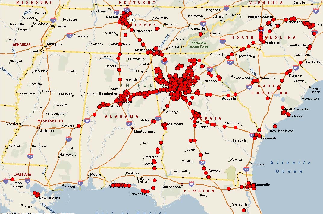
September 29, 2008
Living in Georgia, most of my finds would obviously be here. This gives an overall view of the whole southeast minus South Florida. Number of finds in these areas will fluxuate more since I get into the areas more often.
I've found over 1,000 in GA, over 200 in TN and over 100 in AL. I've found over 50 caches in NC and FL. |
 |
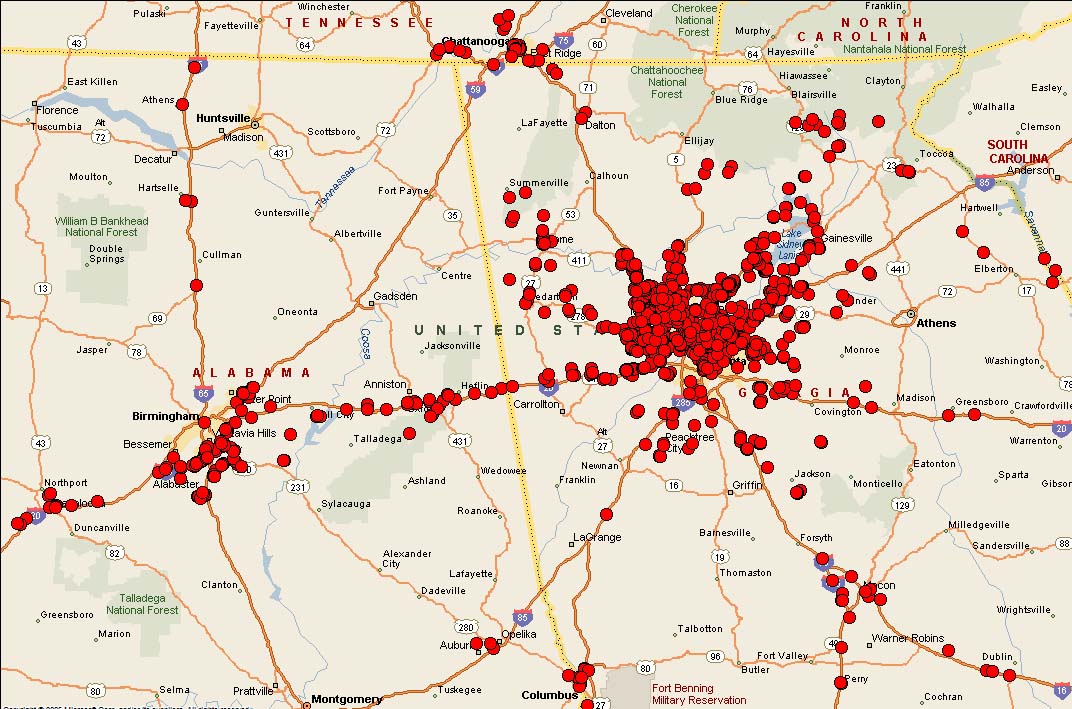
September 29, 2008
Zooming in more, into Atlanta, Birmingham, Chattanooga and Macon. You can see that I travel the Interstate 20 Corridor somewhat frequently.
|
 |
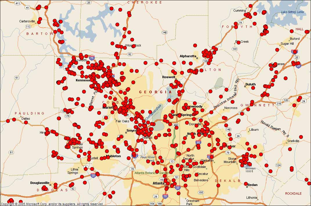
August 23, 2007
The northern part of Atlanta, my main caching stomping grounds. You can see that I live in NW Atlanta by the find density in that area.
This map of Atlanta is not as updated as the one above. It shows an interesting comparison of caches over a year.
|
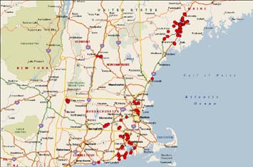 |
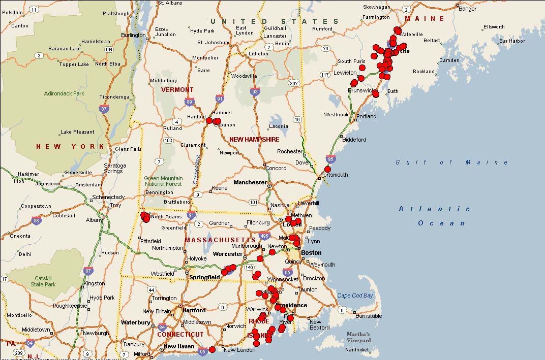
September 29, 2008
The Northeast US.
On a trip to Maine,
I would cache in every spare moment I had. I found 50 caches in a week.
Recently, we went to MA for a short vacation. We decided to do the RI DeLorme Challenge, so you can see the RI finds that got us the coveted final.
|
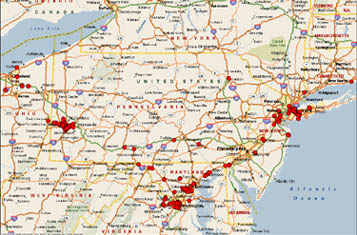 |
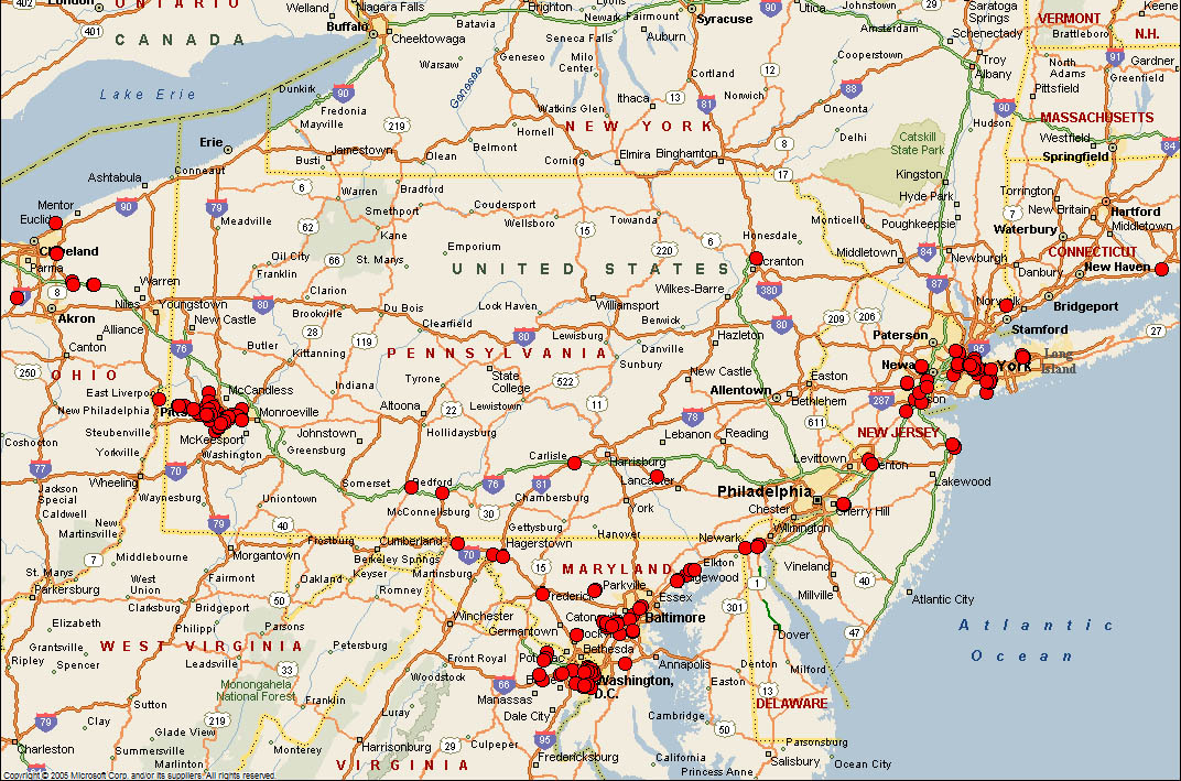
May, 14, 2008
The corridor from NYC down to Washington DC and the Pittsburgh, PA areas.
I have found over 50 caches in PA. Ironically, I have found more caches in DC than in the states of NY, NJ or MD.
A recent trip from Cleveland to Washington DC netted some additional dots on the path between the two.
|
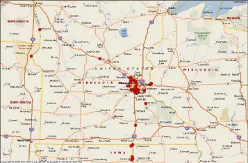 |
August 23, 2007
Minnesota, Wisconsin, Iowa,
South and North Dakota.
I have found over 50 caches in Minnesota too.
|
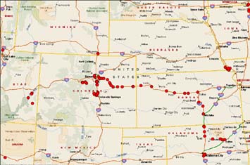 |
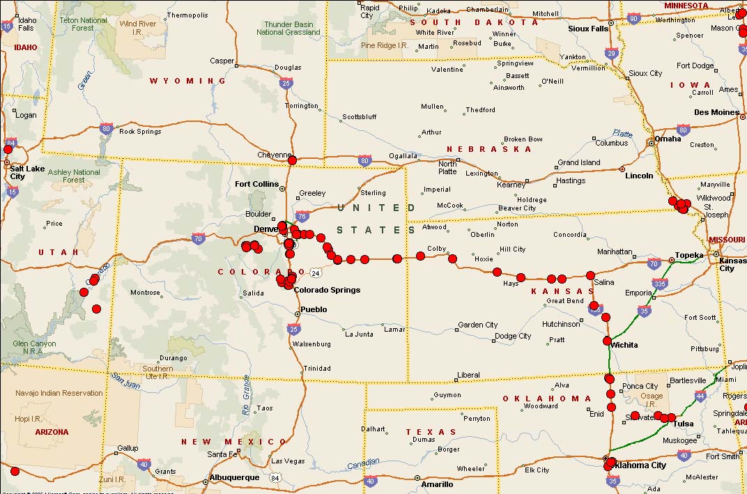
September 29, 2008
The Midwest and the Mountains to Utah.
A few Wyoming caches too.
On a trip to Tulsa, I took a couple of extra days and drove to Colorado. This gave me a chance to do Mingo, the oldest active cache. It is just right of center in KS. I also did a great 4x4 event SW of Denver. Awesome!
|
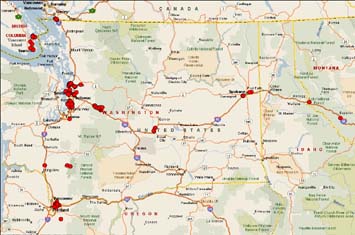 |
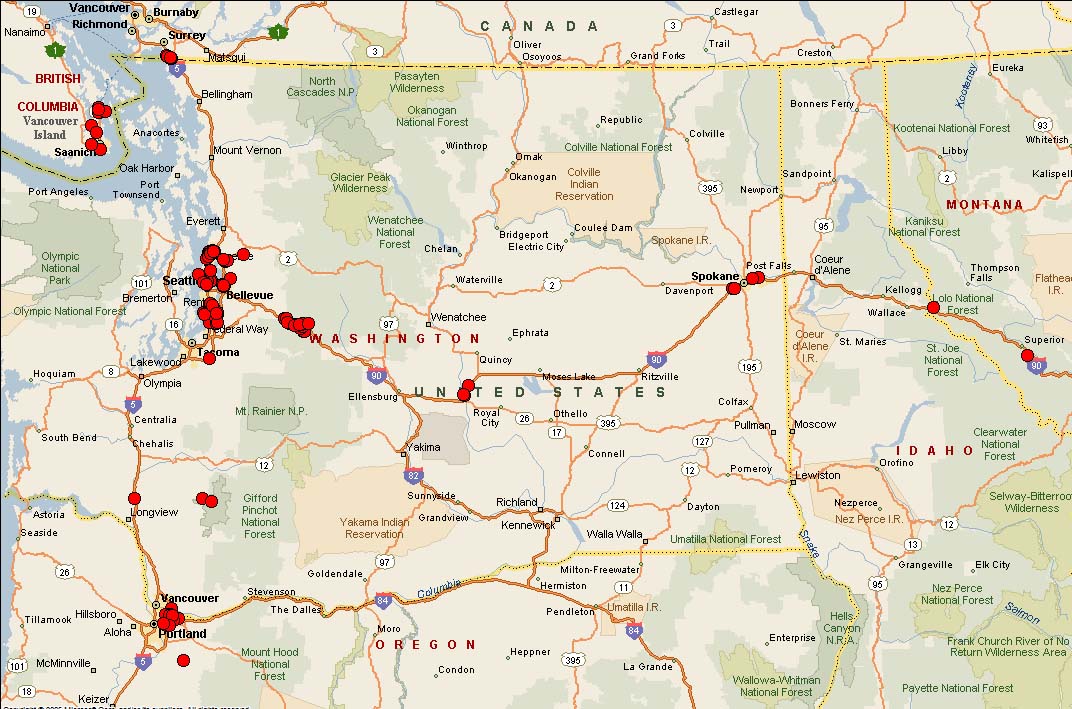
September 29, 2008
Washington State, Oregon, Idaho and Montana. You can also see finds in British Columbia. Our trip to Vancouver Island was one that I will never forget.
I have found over 100 caches in WA state.
|
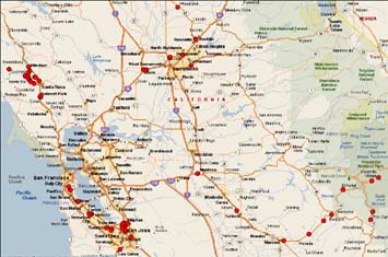 |
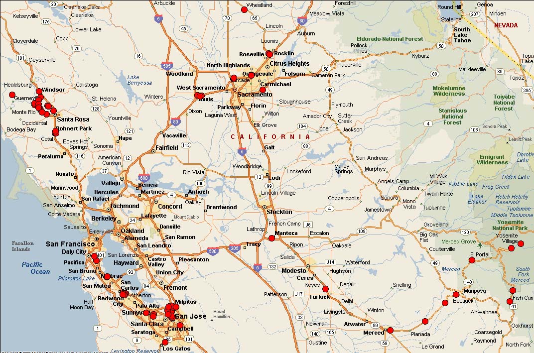
September 29, 2008
Central California.
I have over 100 finds in CA, but they are pretty spread out. In May of 2008 we went to GeoWoodstock! You can see the little dot in Wheatland at the top.
Better yet was our trip to wine country at the top left. We then went to Yosemite. Awesome trip!!!
|
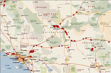 |
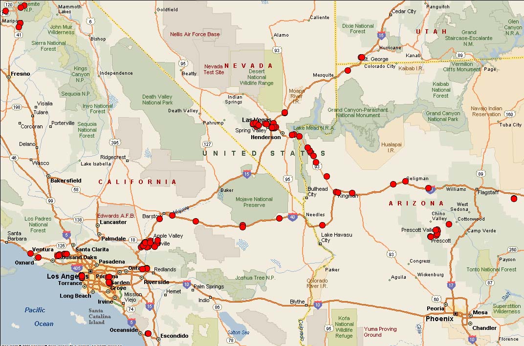
September 29, 2008
Southern California, the Mohave Desert over to Arizona and Nevada.
Some Southern Utah
caches are also shown.
On a trip from LA to Prescott Valley, AZ, I was caching the whole way. The desert is so beautiful and the lava fields east of Barstow, CA are very cool.
|
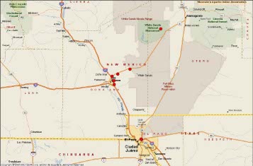 |
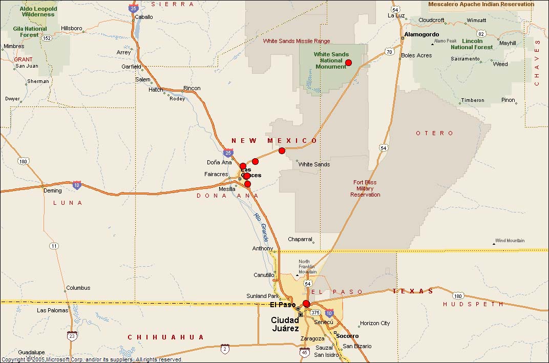
August 23, 2007
New Mexico and West Texas.
White Sands was awesome. I paid for part of my business trip to El Paso just so I could go to White Sands NP. I did hike out to the flat lands by myself, but with a GPS I knew I would not get lost. Getting out to the area that was nothing but sand dunes was incredible. That ant colonies thrive there are wild.
|
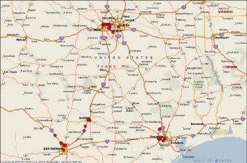 |
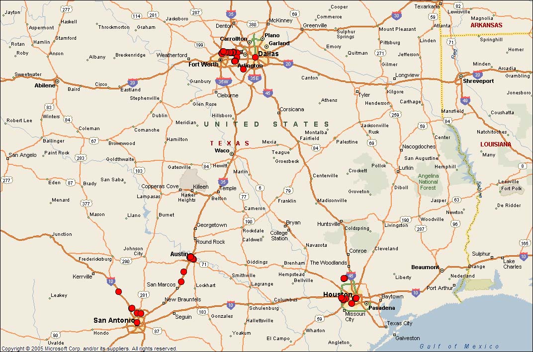
August 23, 2007
Middle Texas.
Dallas, Ft. Worth, Austin,
San Antonio and Houston.
I have also found over 50 caches in Texas. I didn't even find that many caches for Geowoodstock when it was there. It has been a steady progression of finds.
|

This stats map and information show here is generated by the "its not about the numbers" site. You can see all of my finds by color code. This is a fun site. |

| Where I've Cached |
 |
| Maps |
 |
|
The maps with the dots are created using the all finds pocket query, GPSBabel and Microsoft Streets and Trips. First, you get the all finds query. You must be a geocaching.com Premium Member to get this. You need to unzip the file to get the .gpx file. GPSBabel can be found at www.gpsbabel.org and is free. Please make a donation if you use it and like it. It is a great program. Open GPSBabel and convert the all finds .gpx file to a Microsoft Streets and Trips 2002 -2006 .txt file. Open Streets and Trips. From the top menu, select Data/Import Data Wizard. Navigate to the location of the newly created .txt file. Select it and click OK. On the next window, check the "Tab" radio button and click the "Next >" button. On the next window, click the "Finish" button. The map will display with black pushpins. You can change the pushpins by right clicking the pushpin on the far left menu, then select properties. You can change the pushpin to any symbol you want. Upload this map to a location where you can store an image and you can display it here as I have. The full US map can be seen on my profile on the GC.com site.